Old Earth Ministries Online Geology Curriculum© Old Earth Ministries (We Believe in an Old Earth...and God!) NOTE: If you found this page through a search engine, please visit the intro page first.
|
|
Geology - Chapter 2: Earth's Basic SystemsOur planet is perfectly designed by God to function using the physical laws that He set in place. Through these laws, the earth is constantly being modified. These laws can be seen operating in several key systems that He designed. Two systems that we will consider are the hydrologic system and the tectonic system. It is these two systems that are responsible for both removing crustal material through erosion and subduction, and creating new crustal material through deposition and volcanism. We will also briefly examine the concept of isostasy.
|
Lesson Plan
Monday - Read Text Tuesday - Research Wednesday - Quiz Thursday - Review Friday - Test |
|
Parents Information This lesson plan is designed so that your child can complete the chapter in five days. The only decisions you will need to make will be concerning the research task for Tuesday. It is up to you to determine if the student will simply fill in the answers, or provide a short essay answer. You will also need to determine the percentage that this research will play in the overall chapter grade, if any. |
|
|
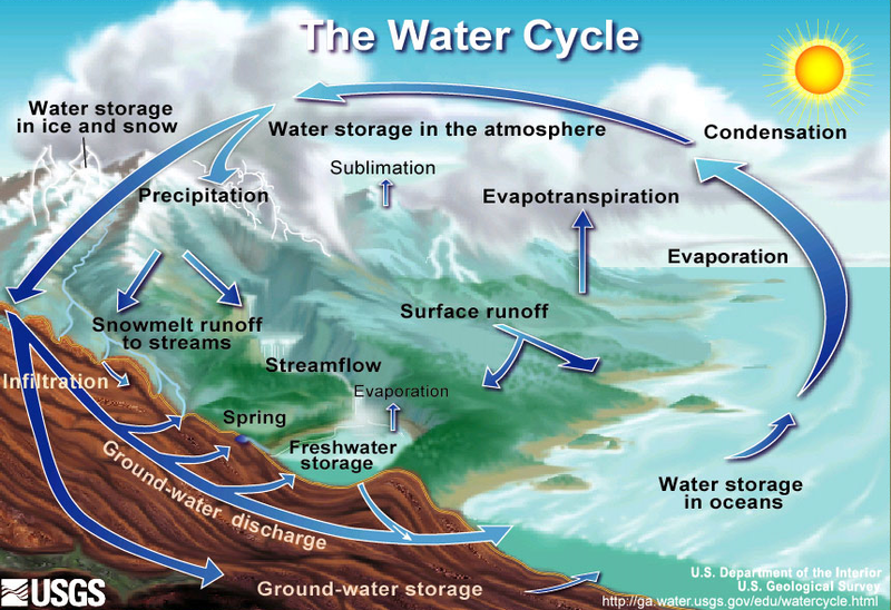
The Hydrologic System The hydrologic
system includes all actions performed by both water and air.
The main catalyst that causes the water cycle is heat. The heat from the sun heats water molecules, and it also causes atmospheric circulation (winds), which increases evaporation. Gravity is another important piece of this puzzle. It is gravity that causes rain to fall, and it also moves the water down slope once it is on the surface of the earth. As water moves down slope, it cuts river channels, which can become deep valleys. Therefore water is the main agent responsible for erosion. As you will see, many of the chapters in this course deal with topics related to the forces of water. There are several
sub-systems of the hydrologic cycle. Probably the most important one
is the formation of river systems. Chapter 10 will
introduce you to the different types of river systems. If you want to
read some more about rivers, Another sub-system
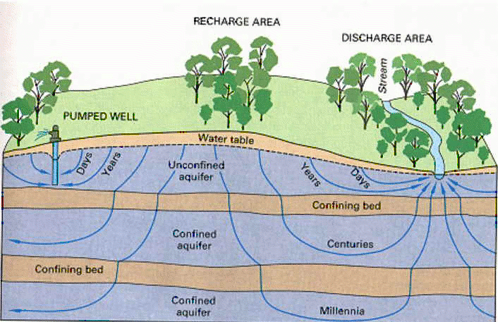
is ground-water systems. Ground water is water that is As water makes its way back to the ocean, it encounters shoreline systems. Through the working of water, these systems form beaches, bars, lagoons, and other coastal features. The final sub-system
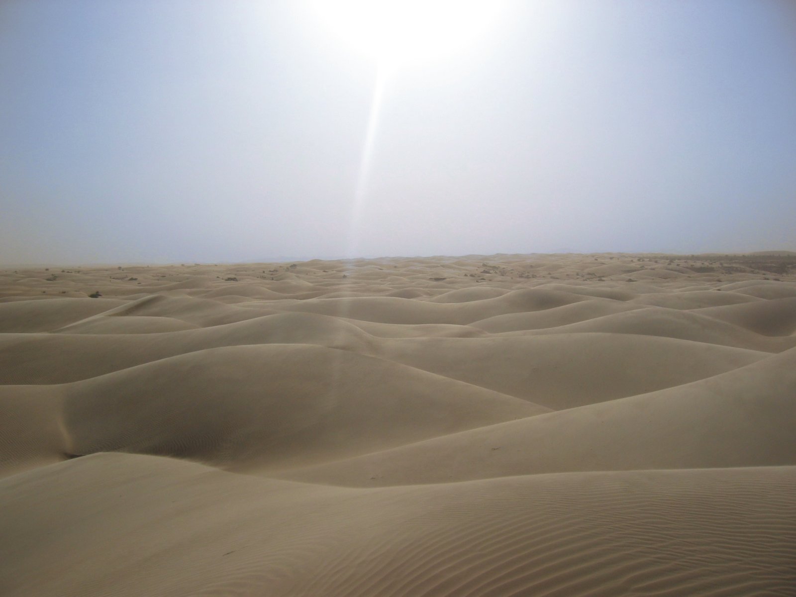
of the hydrologic system is called eolian. Eolian systems You may recall that the energy source for the hydrologic system is heat from the sun. The same is true for its sub-system, eolian systems. Heat causes the wind currents. You will learn more about eolian systems in Chapter 16. To learn more now, see Eolian Processes. The Tectonic System The other major
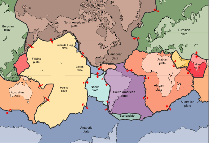
system that affects landforms is the tectonic system. The word
comes from the Greek word for "builder", which is tecton. The earth's
crust is divided into sections, called plates, or tectonic plates.
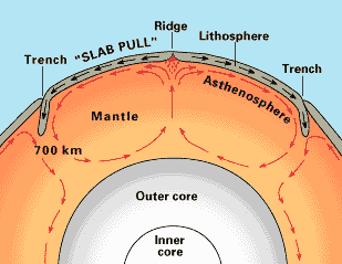
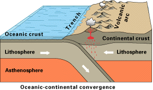
These plates actually move The plates move
because of the convection currents in the asthenosphere, or Tectonic movement is also responsible for the formation of many volcanoes, and they are also the source of many earthquakes. You will learn more about tectonics in a later chapter. To learn more now, see Plate Tectonics. Isostasy Another principle that is important to tectonics is isostasy. Isostasy refers to the state of gravitational equilibrium between the Earth's lithosphere and asthenosphere such that the tectonic plates "float" at an elevation which depends on their thickness and density. For instance, mountain ranges have roots which are just as deep into the ground as they are tall. As the mountains weather and get shorter, they lose mass. They experience isostatic rebound. The depth of the roots rise as the mountains get smaller. Click here to see an animation of mountain range isostasy. Isostasy has actually been measured. When Hoover Dam was constructed in 1935, it added the weight of 24 billion metric tons of water to the area. Within a few years, it caused the circular area around the lake to subside about 5.5 feet (1.7 meters). Other items that can cause subsidence is continental ice sheets. Since we recently had an ice age (11,000 years ago), the weight of the ice caused the land to subside. Geologists can measure the rate of rebound for this land, which is about 5-10 centimeters per 1,000 years (2-4 inches per 1,000 years). Also, ancient lakes, such as Lake Bonneville which was located in Utah, show evidences of rebound. Gravity is the force which causes isostatic adjustments. Isostatic subsidence occurs in places where sediment is being deposited, areas of volcanic activity, regions of glaciation, and under bodies of water. In all these cases, the increase in mass upon the crust causes it to sink until a point of equilibrium is reached. Conversely, isostatic rebound occurs in mountains and other landforms that are eroding away, where glacial ice is melting, and where lake/sea water is decreasing. In these cases, the decrease in mass upon the crust lessens the gravitational effect upon that section of crust, and causes it to rise until it reaches gravitational equilibrium. To learn more, see Isostasy. End of Chapter Research the answers to the following questions about plate tectonics. Your parents may have you simply answer the questions, or they may have you put it in essay form. Please follow your parents instructions. To answer these questions, utilize a search engine to locate the best webpages, or consult a textbook/encyclopedia. You may also use the links at the bottom of this page.
Today you will complete an 11 question practice quiz. The link to the quiz will open a new window. You can come back here and check your answers. Do not click the Back button on your browser during the quiz. After the quiz, continue your research project, if necessary. Please review the terms in bold in the text, and ensure you have completed your research work from Tuesday. Today you will take the end of chapter test. Please close all other browser windows, and click on the link below. During the test, do not click on the Back button on your browser. After you have completed the test, you may proceed to Chapter 3 on your next school day. Please return to the introduction page for the link to the next chapter. Return to the Old Earth Ministries Online Geology Curriculum homepage. Helpful Links
Research Articles on platetectonics.com
|